Utah is selling new maps that show the shaking intensity of earthquakes for the west half of Salt Lake County.
The set of 10 maps also spotlights the risks of landslides, rock falls, floods, radon gas and other hazards in the area.
The Utah State Geological Survey is selling a CD for $25 that contains a set of the maps and a 73-page report.
State geologists say the set will help guide development as population overtakes the west half of the Salt Lake basin.
The maps also spotlight the threat of collapsible or expansive soils, which can wreck buildings.
Copyright 2026 Associated Press. All rights reserved. This material may not be published, broadcast, rewritten or redistributed.
Topics Catastrophe Natural Disasters
Was this article valuable?
Here are more articles you may enjoy.
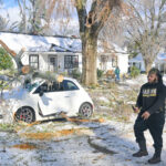 Winter Storm Fern to Cause Up to $6.7B in Insured Losses
  What Analysts Are Saying About the 2026 P/C Insurance Market
  Howden-Driven Talent War Has Cost Brown & Brown $23M in Revenue, CEO Says
  Beazley Agrees to Zurich’s Sweetened £8 Billion Takeover Bid
 From This Issue