New Jersey’s Congressional delegation members sent a letter to the Federal Emergency Management Agency (FEMA), expressing “significant concerns with the methodology” of the Flood Insurance Rate Maps (FIRMs) for New Jersey.
In an Oct. 23 letter to FEMA Administrator Craig Fugate, the lawmakers said the evidence suggests that several core flaws may have exaggerated the flood risk across New Jersey. They urged FEMA to take measures to ensure that the maps are scientifically accurate in order to represent the true risk to communities and individual property owners.
The letter was signed by U.S. Sens. Robert Menendez and Cory Booker (D-N.J.) and Reps. Chris Smith (R-4th Dist.), Frank Pallone (D-6th Dist.), Rodney Frelinghuysen (R-11th Dist.), Frank LoBiondo (R-2nd Dist.), Bill Pascrell (D-9th Dist.), Albio Sires (D-8th Dist.), Leonard Lance (R-7th Dist.), Donald Payne (D-10th Dist.), Donald Norcross (D-1st Dist.), Bonnie Watson Coleman (D-12th Dist.) and Tom MacArthur (R-3rd Dist.).
“Being placed in a greater risk zone results in higher and sometimes unaffordable insurance premiums, reduction in property values, and costly retrofitting. With the consequences of FIRMs being so broad and far-reaching, it is critically important that these maps be objective and accurate,” the lawmakers said in the letter.
The legislators said dozens of New Jersey municipalities, organizations and individuals are appealing the latest FEMA maps.
“We have received letters from multiple boroughs, organizations and individual homeowners who cannot afford the dramatic increases in insurance premiums associated with the FIRMs – increases that appear to go well beyond the risk,” the lawmakers wrote. “In some cases, individuals will simply no longer be able to afford their homes or businesses.”
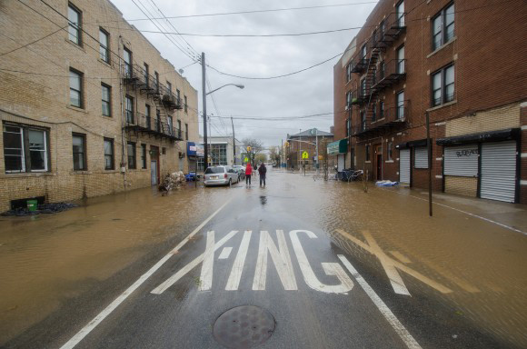
The legislators argued that fundamental methodological errors – including inadequacies in validation and deficient tidal effects – have resulted in erroneous estimates of the 1 percent Flood Risk elevation by several feet.
“This difference has enormous implications for tens of thousands of New Jersey homeowners and small businesses,” the legislators said.
In response, FEMA spokesman Rafael Lemaitre said the federal agency used the best available science and technical data to create the Flood Insurance Rate Maps. “These maps aren’t created in a vacuum. We work closely with community officials, residents and other stakeholders to make sure everyone has input and is included in this process,” he said.
Topics Legislation Flood New Jersey FEMA
Was this article valuable?
Here are more articles you may enjoy.
 Uber Jury Awards $8.5 Million Damages in Sexual Assault Case
  Florida Senate President Says No Major Insurance Changes This Year
  Former Ole Miss Standout Player Convicted in $194M Medicare, CHAMPVA Fraud
  What Analysts Are Saying About the 2026 P/C Insurance Market
 From This Issue