Ten years after Superstorm Sandy pounded New York City’s coastal areas, taking 43 lives and causing $19 billion in damages, many resiliency projects remain years from completion and billions of dollars in recovery funds remain unspent.
According to a report by the New York City Comptroller, the city has spent $11 billion of the nearly $15 billion of federal grants aimed towards Sandy recovery, and a far lower percentage (13.3%) of the $1.9 billion capital funds in the city’s budget for key projects.
The report demonstrates the slow pace of recovery and resiliency spending, according to Comptroller Brad Lander. “The climate crisis is moving far faster than we are,” Lander stated “Superstorm Sandy was a wake-up call for the devastating risks that climate change poses to our city – but from the trudging pace of too many resiliency projects, it seems like we’re still asleep. Without significant improvements to infrastructure design and delivery, New York City will fail to get ready in time for the next storm.”
The city’s capital plan indicates that some of the coastal resiliency projects will not be completed until 2030.
“The climate crisis is moving far faster than we are,” said New York City Comptroller Brad Lander. “Superstorm Sandy was a wake-up call for the devastating risks that climate change poses to our city – but from the trudging pace of too many resiliency projects, it seems like we’re still asleep. Without significant improvements to infrastructure design and delivery, New York City will fail to get ready in time for the next storm.”
The report, Ten Years After Sandy: Barriers to Resilience, also assesses the economic risks to NYC’s real estate, property tax revenue, and essential infrastructure due to expected flooding. The past decade has seen waterfront development steadily increase, and market rate values of real estate in the 100-year floodplain have increased to more than $176 billion – a 44% increase since Superstorm Sandy. Rising tides and more frequent storms will put upwards of $242 billion (a 38% increase at today’s current market value) at risk of coastal flooding by the 2050s, with Brooklyn experiencing the most dramatic increases in property values at risk in coming decades, according to the report.
The report warns that as the floodplain grows, more tax lots will be put at risk, threatening $3.1 billion in annual projected property tax revenues by the 2050s (using current property values).
Significant essential infrastructure including public housing, transportation, recreation, and industrial space lies in the 100-year floodplain. The report identifies some of this property:
- Today, 17% of the city’s public housing buildings are in the 100-year floodplain; this number will grow to 26% by the mid-century.
- 79% of transportation and utility land uses that support electric and gas utilities, rail yards, airports, docks and piers, bridges, tunnels, and highways.
- 67% of open space and outdoor recreation areas, from neighborhood parks for local residents to iconic parks that draw visitors.
- 46% of the city’s industrial and manufacturing that house waste transfer stations, construction businesses, warehouses, and distribution centers.
The report recommends that the city expand its capacity to deliver capital projects on time and on budget, as well as update the city’s long-term resiliency plans to maximize use of forthcoming federal funds to protect vulnerable communities from the climate risks that have grown in the decade since Sandy..
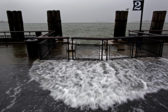
Photo: Waves wash over the sea wall near high tide at Battery Park in New York, Monday, Oct. 29, 2012 as Sandy approaches the East Coast. Sandy continued on its path, forcing the shutdown of mass transit, schools and financial markets, sending coastal residents fleeing, and threatening a dangerous mix of high winds and soaking rain.â (AP Photo/Craig Ruttle)
Was this article valuable?
Here are more articles you may enjoy.


 How One Fla. Insurance Agent Allegedly Used Another’s License to Swipe Commissions
  Trump’s EPA Rollbacks Will Reverberate for ‘Decades’
  The $10 Trillion Fight: Modeling a US-China War Over Taiwan
  Insurify Starts App With ChatGPT to Allow Consumers to Shop for Insurance

