
AIR Worldwide Corporation (AIR), one of the leading providers in catastrophe modeling and weather risk management, announced the release of new typhoon and earthquake models for the Asia-Pacific region.
“The new typhoon models include Taiwan, Hong Kong and the Philippines. The new earthquake models cover Taiwan, the Philippines and Indonesia,” said the bulletin.
“The Asia-Pacific region is an extremely active part of the world in terms of both seismic and tropical cyclone activity,” explained Neil Wiseman, managing director of AIR Ltd. in London. “As the primary and reinsurance markets in Asia continue to develop, managing catastrophe risk will become increasingly important. AIR’s models provide the most comprehensive and reliable data to help insurers and reinsurers make critical decisions with regards to these kinds of extreme events.”
AIR said that “the earthquake models incorporate the most recent seismological and tectonic information, as well as extensive Global Positioning System (GPS) data from more than 350 stations operated throughout the region by organizations such as GEODYSSEA, the joint EC-ASEAN project initiated in 1991 to study crustal deformation patterns.” It also analyzes soil and geological information, “region-specific building types, seismic codes and local construction practices” to develop estimates of damage and insured loss.
The tropical cyclone models “incorporate data on more than 1,250 historical tropical cyclones in the Northwest Pacific Ocean between 1955 and 2000,” said the announcement. “The fully probabilistic storm track generation procedure captures the complete evolution of intensity along the track. High resolution elevation data are used to model the effects of mountainous terrain on wind speeds. Both ridge and sheltering effects are captured, as is the capacity of the high mountains that characterize Taiwan and Philippines to break up storm circulation patterns and actually decrease storm intensity.” It also analyzes local building codes and construction data “to determine damageability and, ultimately, insured loss.”
“The new models are now available in AIR’s CATRADER software application,” it concluded.
Topics Catastrophe
Was this article valuable?
Here are more articles you may enjoy.
 How One Fla. Insurance Agent Allegedly Used Another’s License to Swipe Commissions
 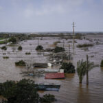 Portugal Deadly Floods Force Evacuations, Collapse Main Highway
  Trump’s Repeal of Climate Rule Opens a ‘New Front’ for Litigation
 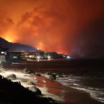 ‘Structural Shift’ Occurring in California Surplus Lines