
According to catastrophe modeling firm AIR Worldwide, “Tropical Cyclone Ita crossed the north Queensland coast near Cape Flattery between 11:00 and 12:00 UTC (9-10 p.m. Australian Eastern Standard Time [AEST]) Friday, April 11, as a Category 4 cyclone (on the Australia cyclone scale; Category 3 on the Saffir-Simpson scale) with maximum winds estimated by the Australia Bureau Of Meteorology (BoM) at 90 knots [103.57 mph] (10-minute sustained).
AIR noted that “Ita weakened from Category 5 (Category 4 on the Saffir-Simpson) to Category 4 in the 12 to18 hours preceding landfall, likely due to an eye wall replacement cycle, which was evident in microwave satellite imagery.
“Currently, indications are that insured losses will be mitigated to a great degree by the strength of the building codes in Queensland, by the sparse population in the vicinity of landfall, and by the relatively small size of the storm.
Kevin Hill, senior scientist at AIR Worldwide, described Ita as a “small cyclone, which should serve to limit the spatial extent of damaging winds. Near the time of landfall, Ita was estimated to have a radius of maximum wind of 15 km [9.82 miles], radius of hurricane force wind of 35 km [21.75 miles], radius of storm force wind of 65 km [40.4 mph], and radius of gale force wind of 160 km [99.5 miles] The area of coast near the landfall location of Ita is sparsely populated, which will also serve to limit damage.”
Since landfall, Ita has been downgraded to a Category 3 storm (Category 2 on the Saffir-Simpson scale) in the most recent (issued at 12:08 a.m. AEST, April 12) BoM advisory. The BoM forecast indicates rapid weakening over the next 12 hours as it tracks to the south-southwest over rough terrain just inland from the coast.
AIR said the system was “forecast to weaken below cyclone intensity overnight Saturday night. On this track, gales may extend south and east to the more populated areas of Cairns and Innisfail, and minor flooding is forecast to occur between Cape Tribulation and Cairns, including Port Douglas.”
Hill noted: “Due to limited wind speed observations, it is difficult to verify the maximum intensity of Ita. Cape Flattery, over which the eye wall of Ita passed, reported a peak 10-min sustained wind of 61 knots (81 mph 1-minute). This station also recorded a minimum pressure observation of 961 mb, although the station did not experience the center of the storm. This value is consistent with the BoM estimated minimum central pressure of 955 mb at landfall.”
Cooktown, a town of ~2,400 people (with about 10,000 in the greater area around it) and located south of the initial landfall location, reported peak 10-min sustained winds of ~42 knots (~55 mph 1-minute) as of 12:00 a.m. AEST, April 12.
According to AIR, at Category 3 and 4 wind speeds, “damage is expected to be significant, particularly to older structures. Local authorities have warned residents that homes and buildings built prior to 1985 will likely suffer significant damage; roughly one-third of homes in Cooktown were built before 1985. Structural damage to houses and buildings may occur, especially to rooftops, while windows and cladding on engineered structures could be damaged by impact from debris. Many trees will likely be uprooted and snapped, blocking roadways or damaging homes and automobiles. For those structures that have been built to code (implemented after Cyclone Tracy in 1974) the structural building practices and requirements set down by the code will help mitigate the effects of high winds and associated debris.”
AIR added that so far “there have been no reports of coastal flood or storm surge at this time. The damage to property in the area of impact will most likely be better known when day breaks in the area and it is safe to go outside.”
Source: AIR Worldwide
Topics Australia
Was this article valuable?
Here are more articles you may enjoy.
 US Roof Maintenance Lags: Hanover
  US Home Insurance Still Priced Too Low for Climate Risk, Says Swiss Re Chair
 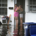 Coverage Needed: Hundreds of Thousands in SE Now in Flood Zones With New Maps
  As Rates Rise, Majority of Homeowners Say Insurance Industry Is in Crisis: Survey