Typhoon Koinu strengthened as the storm headed across the South China Sea toward Hong Kong, contrary to earlier expectations by most meteorologists who had predicted it would weaken.
At 5 p.m. Hong Kong time, Koinu had maximum sustained winds of 145 kilometers per hour (90 mph), putting it near a category two hurricane. According to the latest forecast by the city’s observatory, Koinu will be closest to the finance hub during the day on Sunday, when it will pass to the south with winds near the center of 130 kph.
Hong Kong’s observatory issued its second-lowest storm warning and said it will assess the need for a higher alert depending on the intensity and movement of the typhoon. The higher No. 8 signal effectively shuts down the city by limiting public transport and closing many businesses.
Hong Kong’s Typhoon-Related Insurance Claims Set to Top Record $500M in 2023
Koinu “decided to reintensify” as it tracked the far northern region of the South China Sea, “surprising nearly everyone,” the US Joint Typhoon Warning Center said on its website.
The typhoon earlier brushed past the southern tip of Taiwan, killing one and injuring more than 300 people, according to official figures.
The approaching storm builds on a period of extreme weather for the city, which lies at the northern fringe of the subtropical zone. Just over a month ago, the city was hit by its strongest typhoon in five years. With a maximum sustained wind of 230 kph near its center, Saola was the second-most intense tropical cyclone affecting the South China Sea since 1950, according to Hong Kong’s observatory.
Days later, record-breaking rain caused by the remnants of Typhoon Haikui last month flooded streets, submerged vehicles and triggered landslides.
Hong Kong insurance claims caused by natural disasters may climb to a record and exceed $500 million this year should Koinu bring more heavy rain and cause flood losses, Bloomberg Intelligence analyst Steven Lam said in a note on Wednesday.
The unique topography of Hong Kong — roads and buildings cut into steep hillsides — makes the city vulnerable to flooding and landslides from torrential summer rains that have steadily intensified over time due to climate change.
If the observatory hoists the No. 8 signal, it would be the second straight year the warning has been raised three times, compared with an annual average of twice in the decade through 2022, according to Lam.
At 5 p.m., Koinu was about 260 km east-southeast of Hong Kong and was forecast to move west at about 12 kph across the coastal waters of Guangdong.
The typhoon comes as the city just endured its hottest ever Mid-Autumn festival. September was the wettest on record for that month, as well as having the longest string of consecutive “very hot” days — with the temperature exceeding 33C for 10 days.
Hong Kong’s government is pushing for quicker action on a proposal to keep financial markets open during typhoons, instructing a task force to submit a workable plan within weeks, Bloomberg News reported on Thursday.
The city is one of the only major financial centers to regularly halt trading due to extreme weather. The issue has come to fore as initial public offerings and volumes slump, sapping revenue for Hong Kong’s coffers and undermining the city’s appeal as a financial center.
–With assistance from Dominic Lau, Betty Hou and Elaine To.
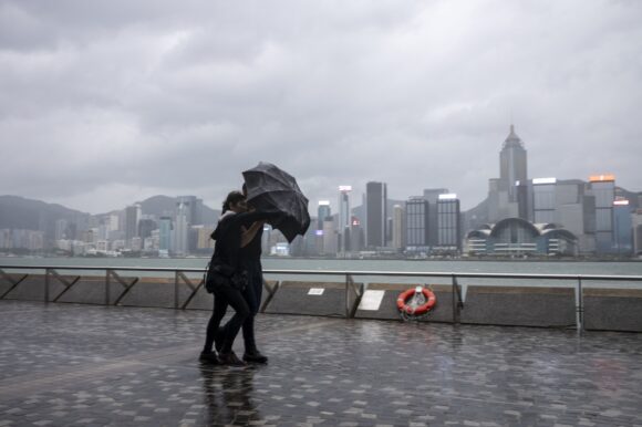
Photograph: Pedestrians brace from the wind and rain on the waterfront in Tsim Sha Tsui district during a No. 8 storm signal raised for Super Typhoon Saola in Hong Kong, China, on Friday, Sept. 1, 2023. Photo credit: Justin Chin/Bloomberg
Related:
Topics Catastrophe Natural Disasters
Was this article valuable?
Here are more articles you may enjoy.


 The $10 Trillion Fight: Modeling a US-China War Over Taiwan
  A 10-Year Wait for Autonomous Vehicles to Impact Insurers, Says Fitch
  Judge Awards Applied Systems Preliminary Injunction Against Comulate
  Trump’s EPA Rollbacks Will Reverberate for ‘Decades’

