
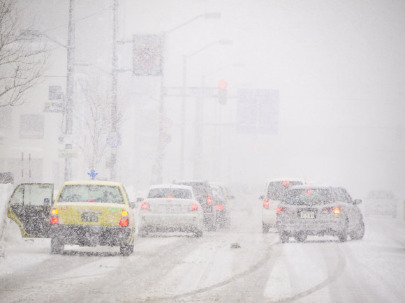
A significant spring storm headed for the northern Plains is packing blizzard conditions with significant snow accumulation and drifting, according to the National Weather Service.
Meteorologists posted a blizzard warning for a large section of western North Dakota and smaller areas of western South Dakota and eastern Montana beginning Tuesday through Thursday evening.
Travel may become difficult to impossible in some places, the weather service predicted.
A winter storm watch was issued for eastern North Dakota, northern South Dakota and northwestern Minnesota. Forecasters were expecting a foot to 2 feet (60.9 centimeters) of snow in some of the affected areas with lesser amounts elsewhere.
“Most long-term residents of the Northern Plains and Rockies know that April can deliver tremendous snowstorms,” AccuWeather meteorologist Brandon Buckingham tell the Bismarck Tribune.
“For example, the Black Hills of South Dakota average 10 to 20 inches of snow during the month of April. It is possible that the Black Hills and other locations in the region could pick up an entire month’s worth of snow from this one storm,” he added.
Western North Dakota could use the moisture. The latest U.S. Drought Monitor map shows the region is abnormally dry or in some form of drought. Northwestern North Dakota is in extreme drought, the second-worst category.
Topics Windstorm
Was this article valuable?
Here are more articles you may enjoy.
 Gun Accessory Company to Pay $1.75 Million to Buffalo Supermarket Shooting Victims
  New York’s Mid-Hudson Insurance to Acquire Hanover Fire of Pennsylvania
  ‘Structural Shift’ Occurring in California Surplus Lines