
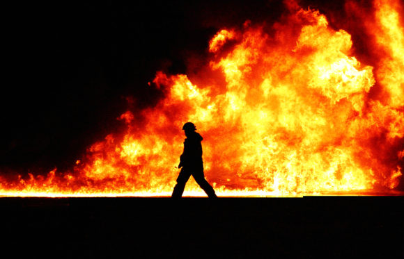
In 2020 alone, more than 10.3 million acres were burned by wildfires across the United States, a level three times higher than the 10-year average from 1990 to 2000 10. Between fire suppression costs, direct and indirect costs, wildfires in 2020 cost the United States upwards of $170 billion. Add in floods, hurricanes, and other natural disasters, and the toll of disasters on Americans is astronomical.
Andre Coleman and a team of researchers at Pacific Northwest National Laboratory (PNNL) are part of the First Five Consortium, a group of government, industry, and academia experts committed to using technology to lessen the impact of wildfires and other natural disasters.
The researchers are expanding PNNL’s operational Rapid Analytics for Disaster Response (RADR) image analytics and modeling suite to mitigate damage to key energy infrastructure. Using a combination of image capturing technology (satellite, airborne, and drone images), artificial intelligence (AI), and cloud computing, Coleman and the team are working to not only assess damage but also predict it.
Accurately forecasting the movement of natural disasters—wildfires, floods, hurricanes, windstorms, tornados, and earthquakes—gives first responders a jump, allowing them to take measures to reduce damage, conduct advanced resource planning, and increase infrastructure restoration time. For example, should a fire reach an electrical substation or other grid infrastructure, an entire community—homes, businesses, and schools—would experience a power outage that could take days to restore.
“This is an exciting and timely effort to apply artificial intelligence to reduce the impact of wildfires, protect energy infrastructure, and ultimately save lives,” said Pamela Isom, acting director of the U.S. Department of Energy (DOE) Artificial Intelligence and Technology Office. “The work has the potential to make a difference in what we expect will be a very challenging wildfire season.”
The PNNL team has been working with these technologies since 2014. The project originally started with the creation of a change-detection algorithm, which analyzes different types of satellite imagery and determines what changed in the landscape after a storm. Authorities use the tool to rapidly assess the physical damage impact of natural disasters, often before ground teams can get in. The first iteration of the tool was used during the 2016 hurricane season to evaluate hurricane damage and determine if energy infrastructure—electric grid, petroleum, and gas facilities—was damaged or at risk.
Coleman and the team now see opportunities to improve RADR response time, damage assessment, visibility, prediction capability, and data accessibility.
To improve timeliness and ground-level assessments, they incorporated new and different image sources. RADR can pull in images from a variety of satellites with different sensing capabilities, including domestic and international government satellites that are offered as open data as well as commercial satellites that are available through the International Disasters Charter.
Having multiple sources of overhead imagery improves response time to just a few hours with the key limitation being the latency of overhead imagery, or the time between images being collected and being available for analysis. Once imagery is received, the RADR software can generate an analysis in about 10 minutes.
To peer through wildfire smoke and cloud cover, the team added infrared imagery to RADR. The new capability provides a clearer view of the landscape that was previously unavailable, giving responders information such as damage to key infrastructure or a safe location for responders to set up relief efforts.
The team is also integrating publicly available and crowdsourced images from social media. Often in a disaster, social media networks like Twitter, Flickr, and Instagram offer real-time data as users post pictures of what is going on around them. By pairing overhead imagery with on-the-ground images, the team can provide a more complete assessment. Satellite images, for example, may show damage to a generation resource, power lines, or the electric grid; however, ground images may indicate otherwise. The tool takes all these images, removes the redundant ones, and sews the images together to provide a more accurate view of changing conditions.
As with any computational model, Coleman notes RADR is only as good as the data. The added imagery sources provide additional data to interpret, improving accuracy. To predict possible outcomes of a wildfire, the team is combining the imagery analysis with weather, fuel, and forecast data. For example, wind, vegetation, and anything a fire can consume all factor into the size of a fire and the direction it takes. By marrying imagery with fuel data and wildfire models, the team hopes to be able to accurately predict the path a fire takes.
Of course, to be useful, the assessments need to get in the right hands. Coordinating a response requires local, regional, and national resources, each in different locations but needing the data as quickly as possible in a format that can be readily accessed and interpreted, particularly in a data communication constrained environment. A cloud-based system provides an end-to-end pipeline for retrieving available imagery, processing the analytics, and disseminating data to be used directly in a user’s own software, through desktop web browsers, and/or via mobile applications. Added visual analytics produce images and datasets that can be easily discernible to a wide audience of responders.
Recent years have brought an increase in the frequency and severity of wildfires, floods, and other extreme weather events. Coleman and the PNNL team hope that, at the very least, the added capabilities of RADR will give responders information they can use to make informed decisions, reduce or plan for damage to key energy infrastructure, plan relief efforts, and save lives.
This work was sponsored by the U.S. Department of Homeland Security, DOE’s Office of Cybersecurity, Energy Security, and Emergency Response, the U.S. Department of Defense’s Joint Artificial Intelligence Center (JAIC), DOE’s Artificial Intelligence and Technology Office, and by PNNL.
Topics Natural Disasters Tech
Was this article valuable?
Here are more articles you may enjoy.
 Remember the Fall of Patriot National? Trial in Suit vs. Mariano’s Lawyers to Begin
  Clash of Florida Titans Pits Powerful Tribe Against Homebuilder Lennar
  Premiums Will Skyrocket by 2035; Discounts Not Enough for Wind Mit, Studies Say
  El Niño Likely Strongest in 75 Years, US Forecasters Say