
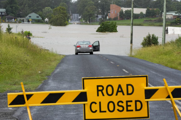
The North Carolina Department of Transportation has armed itself with an advanced flood-warning system designed to help pass the word to motorists on any flood risks to roads, bridges and culverts.
A news release from the department says the system will rely on a network of 400 river and stream gauges. Information will be passed on to department maintenance staff responding to flooded roads and washed-out culverts. It will also benefit local emergency management officials and the public accessing the department’s DriveNC.gov website for timely weather-related closures.
The last major storm to impact the state’s roads was Hurricane Florence in 2018. After that, the legislature gave the department a $2 million grant to develop sophisticated software and install more flood gauges. The system mostly taps into existing gauges operated by other agencies, and it includes an interactive online dashboard and flood mapping based on three-dimensional ground surveys.
One part of the new system covers almost 3,000 miles of state-maintained roads, mostly east of Interstate 95. The system also will allow the department to monitor flood conditions for some 15,000 bridges and culverts statewide. The department’s hydraulics unit has been refining the system and training staff during the past year.
Topics Flood New Markets North Carolina
Was this article valuable?
Here are more articles you may enjoy.
 US Appeals Court Rejects Challenge to Trump’s Efforts to Ban DEI
  Portugal Deadly Floods Force Evacuations, Collapse Main Highway
  Nine-Month 2025 Results Show P/C Underwriting Gain Skyrocketed
  ‘Structural Shift’ Occurring in California Surplus Lines