
The familiar “cone of uncertainty” map, used for years by meteorologists to show a hurricane’s predicted path, is about to get an upgrade – at least temporarily, the National Hurricane Center announced this week.
Starting Aug. 15, the NHC will roll out an experimental cone graphic designed to show inland storm watches and areas that could be affected, including those outside of the storm’s direct path. The change appears to be due to years of questions from residents who may have relied too heavily on the cone map, only to be caught by storm surge and high winds.
“Recommendations from social science research suggest that the addition of inland watches and warnings to the cone graphic will help communicate inland wind risk during tropical cyclone events while not overcomplicating the current version of the graphic with too many data layers,” the NHC said in a bulletin on its website.
Stakeholders will have a chance to provide feedback during the experimental phase, the center noted.
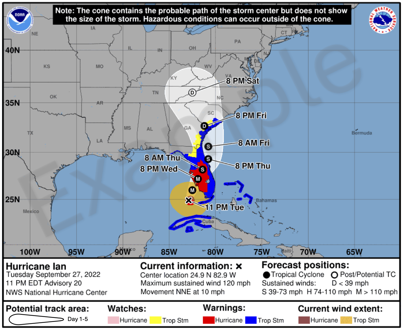
Previously, the cone graphic posted by the NHC as a hurricane or tropical storm approached the U.S. showed only watches and warnings along the coastline. But Hurricane Ian in September and October 2022 left a wide swath of destruction, largely due to inland flooding, through much of Florida and Georgia.
The new maps will show more affected inland areas. The cone also will be shaded transparent, not white, for the entire 5-day forecast for the storm, emphasizing the warning areas more than the path of the tempest.
“A recent unpublished study of alternative cone variations found that the inclusion of inland wind risk information on the cone graphic decreased focus on the storm track and increased focus on wind hazard information compared to the versions of the cone without inland watches and warnings,” the NHC explained.
The change is part of a 20-year evolution in the hurricane center’s forecasting maps. The cone of uncertainty has steadily narrowed over the years as the center recalculates the cone based on tracking errors from previous storms, the Miami Herald reported.
The newspaper also noted that the center this year will produce more storm advisories in Spanish.
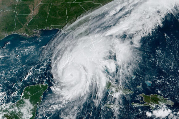
Photo: Hurricane Ian (NOAA via AP, File)
Was this article valuable?
Here are more articles you may enjoy.
 Trapped Tesla Driver’s 911 Call: ‘It’s on Fire. Help Please’
  GEICO Settles Call-Center Worker Suits for $940,000; Attorneys Get Half
  The $3 Trillion AI Data Center Build-Out Becomes All-Consuming for Debt Markets