One out of every four houses within 500 feet of the U.S. shoreline will become a casualty of erosion within the next 60 years.
This hard-hitting fact is among many included in the report, Evaluation of Erosion Hazards, recently released by the Federal Emergency Management Agency (FEMA).
“It’s a fairly dramatic conclusion,” said David Farmer, senior vice president of federal affairs for the Alliance of American Insurers. “This is an issue that insurers and reinsurers worldwide have been concerned about…What we saw in this report is some concrete evidence that there is really a need for a public policy debate on the issue of development in these environmentally sensitive areas.”
In requesting the study in 1994, the aim of Congress was to determine not only how erosion impacts coastal communities but also whether (or how) federal programs, such as FEMA’s National Flood Insurance Program (NFIP) might provide solutions to the problems caused by that erosion. The nonprofit John H. Heinz III Center for Science, Economics and the Environment was selected by FEMA to conduct the study.
Other findings indicate that owners of property located within the first few feet of the nation’s coastlines are exposed to a risk from erosion equivalent to that from flooding. Of the total of 338,000 structures situated within 500 feet of the U.S. shoreline, about half are located on the Atlantic coast and 20 percent are on the Pacific coast, while the remaining 17 percent and 13 percent are located on the Gulf of Mexico and Great Lakes coastlines, respectively.
“We delivered the report to FEMA with recommendations for Congress on how they should address some of these issues,” said Steve Dunn, deputy project manager for the Heinz Center.
Two of the more significant of those recommendations are that Congress instruct FEMA to prepare and disseminate detailed erosion maps (similar to the flood risk maps already in existence), and that erosion hazards should be taken into consideration in the determination of rates for federal flood insurance.
The study found that about half of homeowners in high erosion coastal areas on the Atlantic and Gulf coasts have flood policies through the NFIP, and even though certain types of erosion damage are not included under that program’s rules, it has paid the majority of claims for such losses sustained by policyholders in low-lying areas. In addition, flood policyholders in non-eroding areas pay the same premiums as flood policyholders in eroding areas, despite the increased level of risk for the latter.
“The [NFIP] right now only includes risks from flooding,” Dunn explained. “FEMA does not map erosion hazards. That risk is not incorporated into the rates now. We found that to fully reflect risk, insurance rates in the highest risk coastal areas would have to be on average about twice today’s rate to reflect the combined risk from flooding and erosion.”
Dunn said it was feasible that the mapping could be conducted within a couple of years, and the maps could then be periodically updated. “A map would be useful [for] about 10 years,” he said. “Essentially, the cost would be a $5 million per year appropriation to provide enough funds to initiate a mapping program and maintain the maps.”
Considering that the report estimates an average annual loss to coastal property owners of $530 million, including damage to structures and loss of land, the appropriation would appear to be a comparably small expense.
To address the issue of what impact a rate hike might have on NFIP enrollment levels, Dunn said a mail survey of property owners, roughly 11,000 houses around the shore, was conducted. “We designed a willingness-to-pay question into the survey,” he said. “We found that greater than 50 percent would be willing to pay up to about an additional $2 per $100 for erosion coverage.”
Dunn added that the Heinz Center also found an approximate 15 percent increase in development density that was attributable to the NFIP. On the other hand, for those structures built since the program standards went into place, the overall damage occurring is reduced.
“Ever since the inception of the [NFIP], they’ve been refining the program,” said Farmer, who added that over time, it has become more difficult to get insurance in hazardous zones as the government attempts to limit its losses in the sale of flood insurance. However, he noted that in the case of the coastal areas, there are two types of markets: flood insurance provided by FEMA through the NFIP and homeowners insurance sold by private companies.
“Within the private companies, there are residual pools that provide some of that coverage,” Farmer stated. “Nonetheless, if you build houses, then people need mortgages for those houses, and then people need homeowners coverage…So you end up creating a system where you’ve got political pressure on the private industry to provide the coverage.”
Farmer emphasized his hope that the public debate sparked by the new erosion study would cause policymakers at the local and state level, either through coastal protection acts or through local zoning ordinances, to reevaluate the long-term effects of gaining tax revenue from the development of houses in hazardous areas. He also expressed the belief that the present system creates an unfair subsidy for some individuals.
“You may be burdening taxpayers and premium payers with an additional form of taxation by rebuilding those homes that probably shouldn’t have been built there in the first place,” Farmer said, adding that from his perspective, the debate will really be on new construction.
Dunn agreed that the report is not telling people to pack up and move away from the coast. “We just want them to pay for their fair share,” he concluded.
Topics Flood Agribusiness FEMA
Was this article valuable?
Here are more articles you may enjoy.
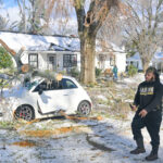 Winter Storm Fern to Cause Up to $6.7B in Insured Losses
  Chubb Posts Record Q4 and Full Year P/C Underwriting Income, Combined Ratio
  Allstate CEO Wilson Takes on Affordability Issue During Earnings Call
 From This Issue