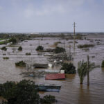
In the eastern Pacific, Hurricane Felicia is moving towards Hawaii. As of the National Hurricane Center’s 11:00 EST advisory on Thursday, Hurricane Felicia — currently at category 4 strength — is in the Eastern Pacific 1545 miles southeast of Hilo, Hawaii, moving northwest at 10 mph with maximum sustained winds of 140 mph. Felicia is expected to make landfall on Hawaii’s Big Island on Monday, Aug. 10.
“Felicia is forecast to begin losing strength today, downgrading to tropical storm or tropical depression status by the time it reaches the Hawaiian Islands,” said Dr. Peter Dailey, director of atmospheric science at risk modeling company AIR Worldwide. “Although sea surface temperatures are warm enough to support hurricane intensity, wind shear is quite strong and will likely begin to tear the hurricane apart. The likelihood that Felicia will produce hurricane force winds over land is small.”
Meanwhile, a category 3 typhoon is forecast to strike northern Taiwan on Friday 7 August. Typhoon Morakot — currently a category 1 typhoon — is approximately 445 km (276 miles) east-southeast of Taipei, Taiwan, as of the Joint Typhoon Warning Center’s advisory today. It is moving westward towards the island at 15 mph, packing maximum sustained winds of 92 mph and gusts of 115 mph. This storm is the eighth named storm of this year’s western Pacific cyclone season, which so far is showing less activity than average.
Morakot is forecast to shift to the northwest today and cut a path towards Taiwan’s northern region. According to the Japan Meteorological Agency (JMA), Morakot is forecast to strengthen prior to landfall, reaching a peak intensity of category 3 (winds of at least 178 km per hour). The JMA’s forecasted landfall central pressure and location resemble those of Typhoon Krosa in 2007, which caused widespread wind damage to non-structural elements as well as flooding in Taiwan.
“Although Morakot is taking a route typically followed by typhoons approaching northern Taiwan, the Central Mountain Range of Taiwan will likely cause a deflection in track, and/or cause Morakot to temporarily stall,” said Dr. Peter Sousounis, principal atmospheric scientist, AIR Worldwide. “Following landfall, an approaching low pressure trough from the west is expected to redirect the storm more towards the northwest. The storm may then make a second landfall over the weekend on the Chinese mainland—either in Fujian Province or Zhejiang Province.”
Source: AIR Worldwide
Was this article valuable?
Here are more articles you may enjoy.


 Q4 Global Commercial Insurance Rates Drop 4%, in 6th Quarterly Decline: Marsh
  Insurance Broker Stocks Sink as AI App Sparks Disruption Fears
  Florida Insurance Costs 14.5% Lower Than Without Reforms, Report Finds
  Portugal Deadly Floods Force Evacuations, Collapse Main Highway

